Covid-19-data: break NYC data by county/borough
The "county" data for New York City is currently provided as a single NYC record, with no FIPS which causes problems for wanting to join this to county GIS data boundaries and demographics:
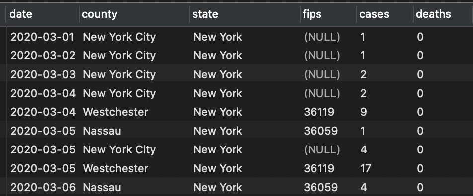
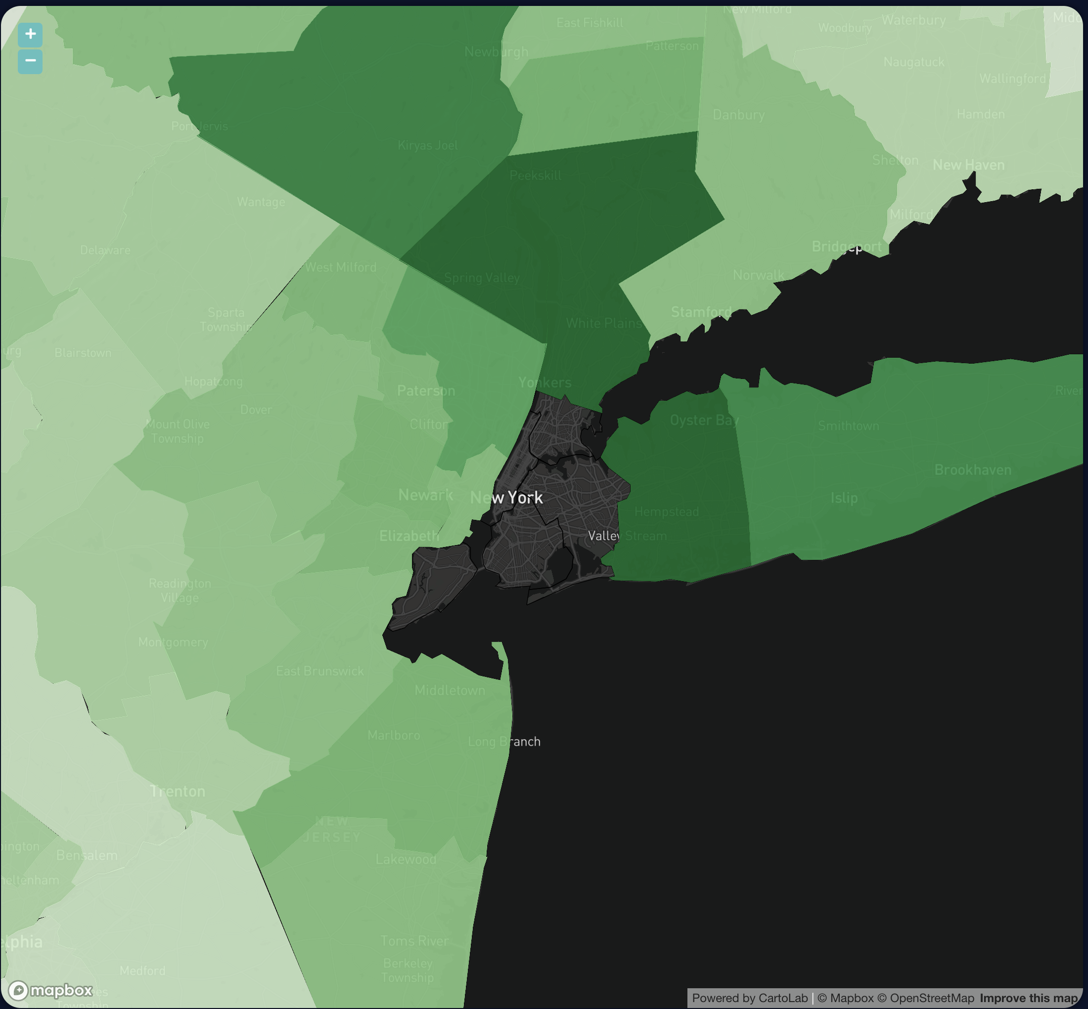
Why not provide the individual counties and FIPS codes for NYC?
 brambow
All 5 comments
Followup question: is it NYC that is combining or is it the NYT? If NYT, agree, it would help to break this out.
 InformationForHumans
on 29 Mar 2020
InformationForHumans
on 29 Mar 2020
The data NYC provides daily is broken into boroughs: https://www1.nyc.gov/assets/doh/downloads/pdf/imm/covid-19-daily-data-summary.pdf
Before I started using the NYT dataset, I was using county-level data from https://usafacts.org/visualizations/coronavirus-covid-19-spread-map/, which also broke it into the 5 boroughs. NYT's data is in an easier format to ingest and update though, so it'd be nice if they also provided the detailed borough data.
brambow
on 29 Mar 2020
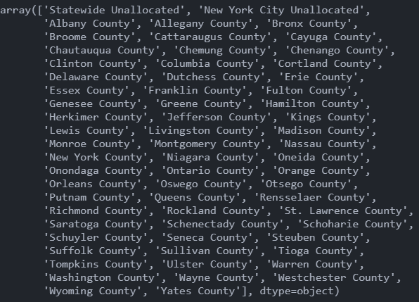
usafacts now have it:
https://usafacts.org/visualizations/coronavirus-covid-19-spread-map/
 StevenLi-DS
on 29 Mar 2020
StevenLi-DS
on 29 Mar 2020
The data set is great and highly usable, but the lack of NYC borough/county values is a major problem for many toolchains. Would greatly appreciate a breakdown by NYC county. Thanks!
 arenn
on 2 Apr 2020
arenn
on 2 Apr 2020
Seems like nytimes has it.
StevenLi-DS
on 4 Apr 2020
Related issues
 threebrooks
·
3Comments
threebrooks
·
3Comments
 harley164
·
5Comments
harley164
·
5Comments
 aminnagpure
·
3Comments
aminnagpure
·
3Comments
 bcunning
·
5Comments
bcunning
·
5Comments
 knwpsk
·
4Comments
knwpsk
·
4Comments
Most helpful comment
The data NYC provides daily is broken into boroughs: https://www1.nyc.gov/assets/doh/downloads/pdf/imm/covid-19-daily-data-summary.pdf
Before I started using the NYT dataset, I was using county-level data from https://usafacts.org/visualizations/coronavirus-covid-19-spread-map/, which also broke it into the 5 boroughs. NYT's data is in an easier format to ingest and update though, so it'd be nice if they also provided the detailed borough data.