Openmaptiles: Water disappears in Crimea at zooms 6 and 7
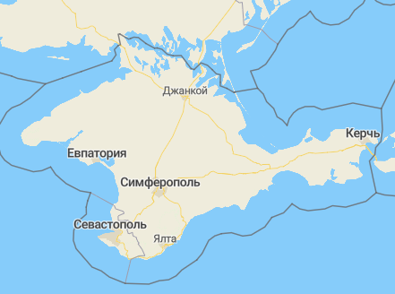
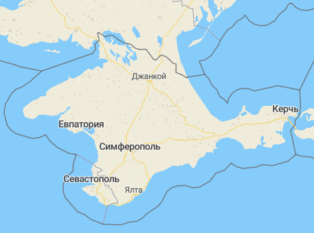
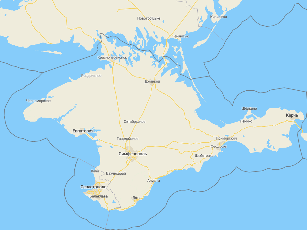
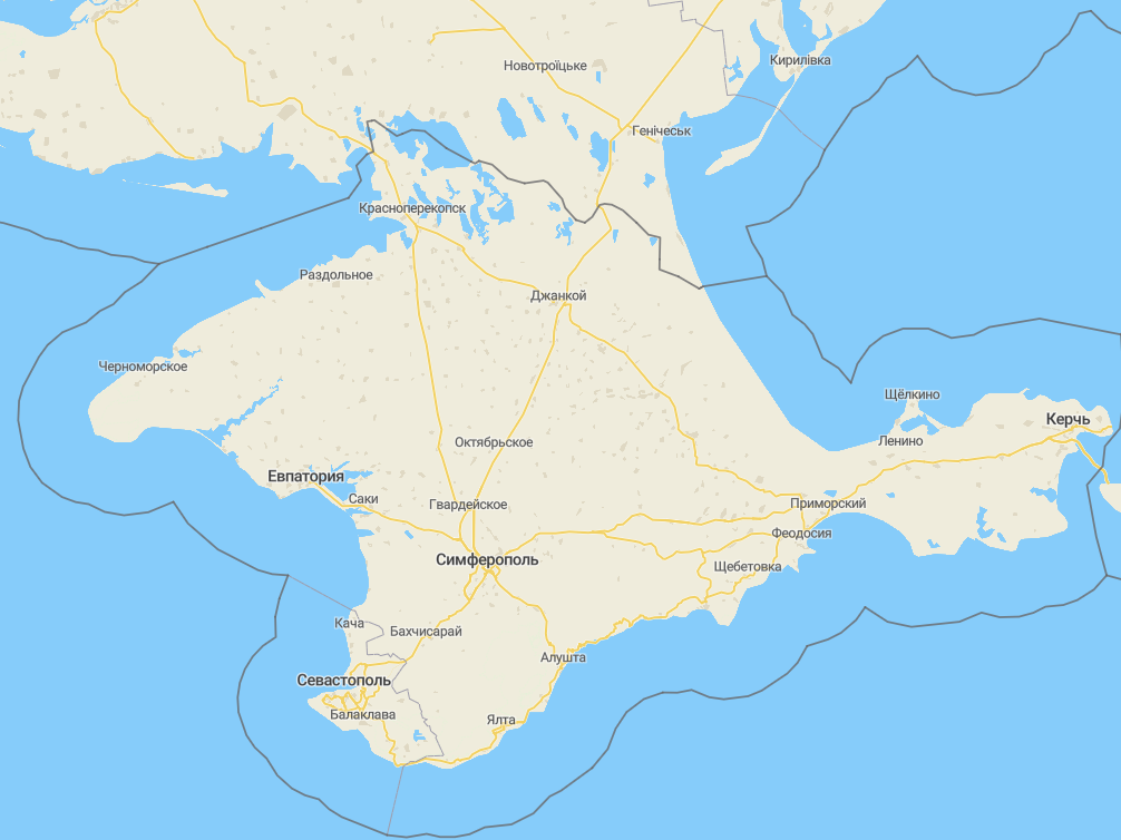
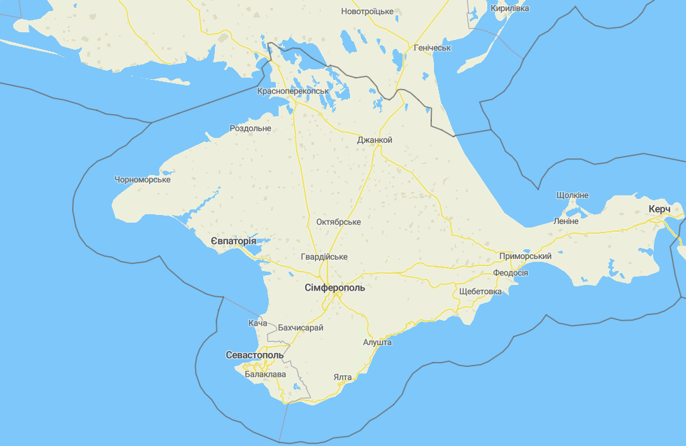
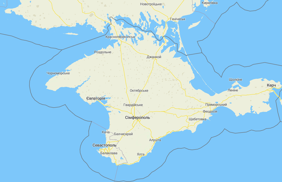
At zooms 6 and 7 some areas in Crimea that are covered with water disappear. I used the revision https://github.com/openmaptiles/openmaptiles/commit/0545f1e27d1783c2a300db4eadaa26cef3dcb705 to generate new tiles.
This is how it was before (zoom 6):
And this is how it is with the new OMT revision (zoom 6):
The same for zoom 7:
 golubev
All 4 comments
Thanks for reporting this.
It is a problem of combining data sources - till z8 we use ocean polygons from import-water, starting z7 they come from Natural Earth. In Natural Earth is this problematic water area classified as lake, not part of ocean, this way it is in different dataset (this NE dataset is used starting z5).
https://github.com/openmaptiles/openmaptiles/blob/master/layers/water/etl_diagram.png
It could be easily solved by using import-water source for oceans in z6 and z7 too, I will test it.
 eva-j
on 12 Dec 2019
eva-j
on 12 Dec 2019
Thanks, @eva-j!
That area is really like a lake - it is a large system of lagoons - https://en.wikipedia.org/wiki/Syvash
golubev
on 12 Dec 2019
eva-j
on 12 Dec 2019
Before fix:
After the fix:
Thanks, @eva-j :wave:
golubev
on 18 Dec 2019
Related issues
 edpop
·
5Comments
edpop
·
5Comments
 kleper
·
4Comments
kleper
·
4Comments
 otherjason
·
6Comments
otherjason
·
6Comments
 taoweibang
·
4Comments
taoweibang
·
4Comments
 jirik
·
5Comments
jirik
·
5Comments
Most helpful comment
https://github.com/openmaptiles/openmaptiles/pull/730 merged.