Openmaptiles: Indonesia and Philippines names missing
Names for Indonesia and Philippines come very "late" if zoomed in - they are missing completely on lower zoom tiles (0-4 zoom), appear on zoom 5 but even there with very low rank (6). Even East Timor has higher ranking. As result everyone will get map without names of the 2 largest and most populous countries in the region (your sample map style):
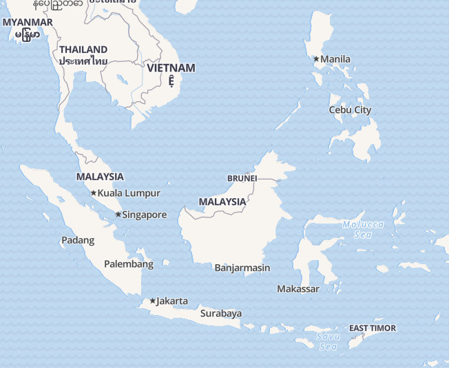
 jaakla
All 6 comments
hello some additional comments on this issue:
first, it looks like there are actually no country labels that are in
rank 4 or 5so you basically jump from3 to 6with nothing in between- I assumed that rank was
1-6as noted in their schema documentation:
"The rank field for countries and states ranges from 1 to 6"
- I assumed that rank was
second, since there are no labels introduced in these ranks, the next (and highest level) is
6.- as you can imagine, labels for countries like Indonesia, Philippines, Singapore, Denmark, etc. that should be in lower ranks will be labeled differently than places that should probably be in higher ranks.
- In
rank 6, we have everything like small island labels as well. As a consequence, there will not be the proper hierarchy of label sizes. - For example, adding the labels requested, you will see that a place like East Timor (that has a
rank of 3) will be a lot larger than the label for Indonesia, Singapore, etc -- is this "correct"?:
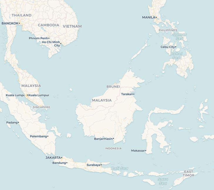
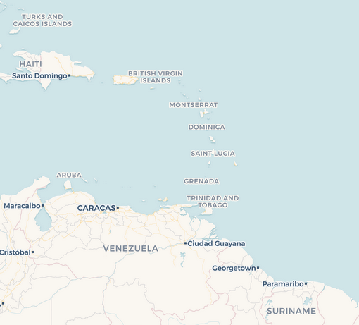
- this is because for other places that have
rank=6can't and should not be labeled with the same hierarchy as lower rank countries:
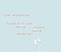
third, without a better distribution of ranking, we will run into unintended consequences like this label cluster at z6:
cc @jaakla
 makella
on 16 Nov 2017
makella
on 16 Nov 2017
Another one I noticed that is in rank=6 is Denmark. Not sure if there are others as well...
makella
on 16 Nov 2017
@jaakla @makella
The initial issue of missing names is fixed (tested on Philippines and Denmark).
@makella Could you please move the first additional comment to separate issue? I guess at least something from your second comment is fixed by 30539e7. The third comment is related to #224 and you should be able to improve it in GL style using symbol-avoid-edges.
 jirik
on 20 Nov 2017
jirik
on 20 Nov 2017
@makella I've reflected the first comment in https://github.com/openmaptiles/openmaptiles/commit/2097b2c31b16167faf358d48bb35a23c68e28285
rank | number of countries before the change | number of countries after the change
--- | --- | ---
1 | 36 | 36
2 | 88 | 88
3 | 57 | 59
4 | 3 | 15
5 | 2 | 33
6 | 69 | 24
jirik
on 20 Nov 2017
@jirik thank you for looking into this for us!
which part of the issue should i move?
in regards to #3, this is the raster styling with CartoCSS. We have been able to remove some of the cut off labels with a combination of text-wrap-width, and other properties through zoom. I don't want to use text-avoid-edges on country or city labels as it really reduces the amount of labels and one label that shows at one zoom might not at the other.
i'm not sure if there is a buffer in the vector tiles (?)
in general, any additional information on this would be extremely helpful.
makella
on 20 Nov 2017
@makella As I already implemented the first part, I think there is no need to create new issues. I hope https://github.com/openmaptiles/openmaptiles/commit/30539e78d193d9a471aaea5581372b3d0702a524 and 2097b2c addresses key parts of what you've described.
The buffer is specified per layer. For place layer it is currently 256 (the highest among all layers).
jirik
on 20 Nov 2017
Related issues
 boldtrn
·
3Comments
boldtrn
·
3Comments
 heikkipora
·
4Comments
heikkipora
·
4Comments
 rpieciorak
·
5Comments
rpieciorak
·
5Comments
 Rajavelu
·
3Comments
Rajavelu
·
3Comments
 init-js
·
5Comments
init-js
·
5Comments
Most helpful comment
@makella I've reflected the first comment in https://github.com/openmaptiles/openmaptiles/commit/2097b2c31b16167faf358d48bb35a23c68e28285
rank | number of countries before the change | number of countries after the change
--- | --- | ---
1 | 36 | 36
2 | 88 | 88
3 | 57 | 59
4 | 3 | 15
5 | 2 | 33
6 | 69 | 24