Openmaptiles: Missing islands in Norway near Oslo
OpenStreetMap has islands that are missing from OpenMapTiles vector tileset
OpenStreetMap:
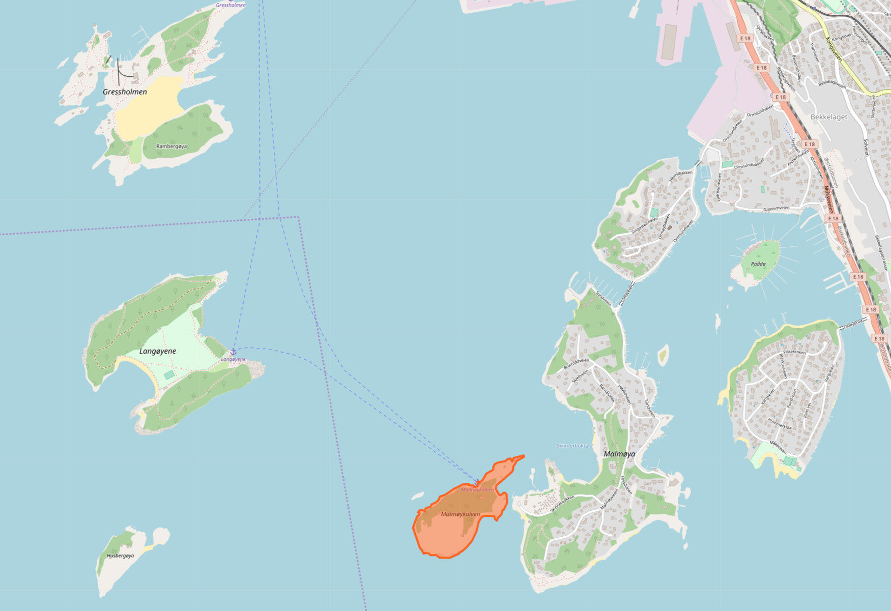
OpenMapTiles:

 heikkipora
All 4 comments
Island (or generally land) polygons are not encoded in openmaptiles. Only water polygons are. The rest of the planet is considered as land.
The problem here is that water polygon Bunnefjorden does not contain "holes" of islands, so it's data related issue.
https://www.openstreetmap.org/relation/6812187
Solution: Add island holes to Bunnefjorden relation.
 jirik
on 5 Nov 2018
jirik
on 5 Nov 2018
👍2
 pathmapper
on 5 Nov 2018
pathmapper
on 5 Nov 2018
@pathmapper Great, thank you!
jirik
on 6 Nov 2018
Thanks! (also for the clarification of how water & land works in openstreetmap dataset :-) )
heikkipora
on 6 Nov 2018
Was this page helpful?
0 / 5 - 0 ratings
Related issues
 hpn0t0ad
·
3Comments
hpn0t0ad
·
3Comments
 otherjason
·
6Comments
otherjason
·
6Comments
 kleper
·
4Comments
kleper
·
4Comments
 sheub
·
4Comments
sheub
·
4Comments
 Rajavelu
·
3Comments
Rajavelu
·
3Comments
Most helpful comment
Island (or generally land) polygons are not encoded in openmaptiles. Only water polygons are. The rest of the planet is considered as land.
The problem here is that water polygon Bunnefjorden does not contain "holes" of islands, so it's data related issue.
https://www.openstreetmap.org/relation/6812187
Solution: Add island holes to Bunnefjorden relation.