I have put a question on stackoverflow, which unfortunately has not resulted in any answers.
I have this code, which produces hillshading in raster:
library(raster)
alt = getData('alt', country='CHE')
slope = terrain(alt, opt='slope')
aspect = terrain(alt, opt='aspect')
hill = hillShade(slope, aspect, 40, 270)
plot(hill, col=grey(0:100/100), legend=FALSE, main='Switzerland')
plot(alt, col=rainbow(25, alpha=0.35), add=TRUE)
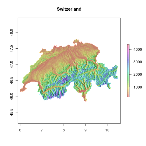
The next step would be add layers (towns, roads, etc) in tmap.
library(tmap)
tm_shape(hill) + tm_raster() + tm_shape(alt) + tm_raster()
does not give the required result. How could this be done?
 carbonmetrics
All 3 comments
library(raster)
#> Loading required package: sp
alt = getData('alt', country = 'CHE')
slope = terrain(alt, opt = 'slope')
aspect = terrain(alt, opt = 'aspect')
hill = hillShade(slope, aspect, 40, 270)

library(tmap)
tm_shape(hill) +
 tm_raster(palette = gray(0:100 / 100), n = 100, legend.show = FALSE)  +
  tm_shape(alt) +
  tm_raster(alpha = 0.5, palette = terrain.colors(25),
            legend.show = FALSE)
#> Linking to GEOS 3.6.1, GDAL 2.2.4, proj.4 4.9.3

Created on 2018-09-04 by the reprex package (v0.2.0).
You can see a similar example in the geocompr book - the source code is at https://github.com/Robinlovelace/geocompr/blob/master/05-geometry-operations.Rmd.
 Nowosad
on 4 Sep 2018
Nowosad
on 4 Sep 2018
👍1
Thanks! This works. BTW have you seen the rayshader package? Can't get it to work with tmap. It can even print your maps on a 3D printer...
carbonmetrics
on 4 Sep 2018
👍2
AFAIK rayshader has no sense of space in a geographic sense, i.e. only works on matrices without projection information.
 tim-salabim
on 4 Sep 2018
tim-salabim
on 4 Sep 2018
Was this page helpful?
0 / 5 - 0 ratings
Related issues
 prosoitos
·
5Comments
prosoitos
·
5Comments
 MatthieuStigler
·
3Comments
Nowosad
·
5Comments
Nowosad
·
4Comments
MatthieuStigler
·
3Comments
Nowosad
·
5Comments
Nowosad
·
4Comments
 hbermeo
·
8Comments
hbermeo
·
8Comments
Most helpful comment
Thanks! This works. BTW have you seen the rayshader package? Can't get it to work with tmap. It can even print your maps on a 3D printer...