Isis3: deltack on CRISM data: wavy output from cam2map
ISIS version(s) affected: 3.9.1
Description
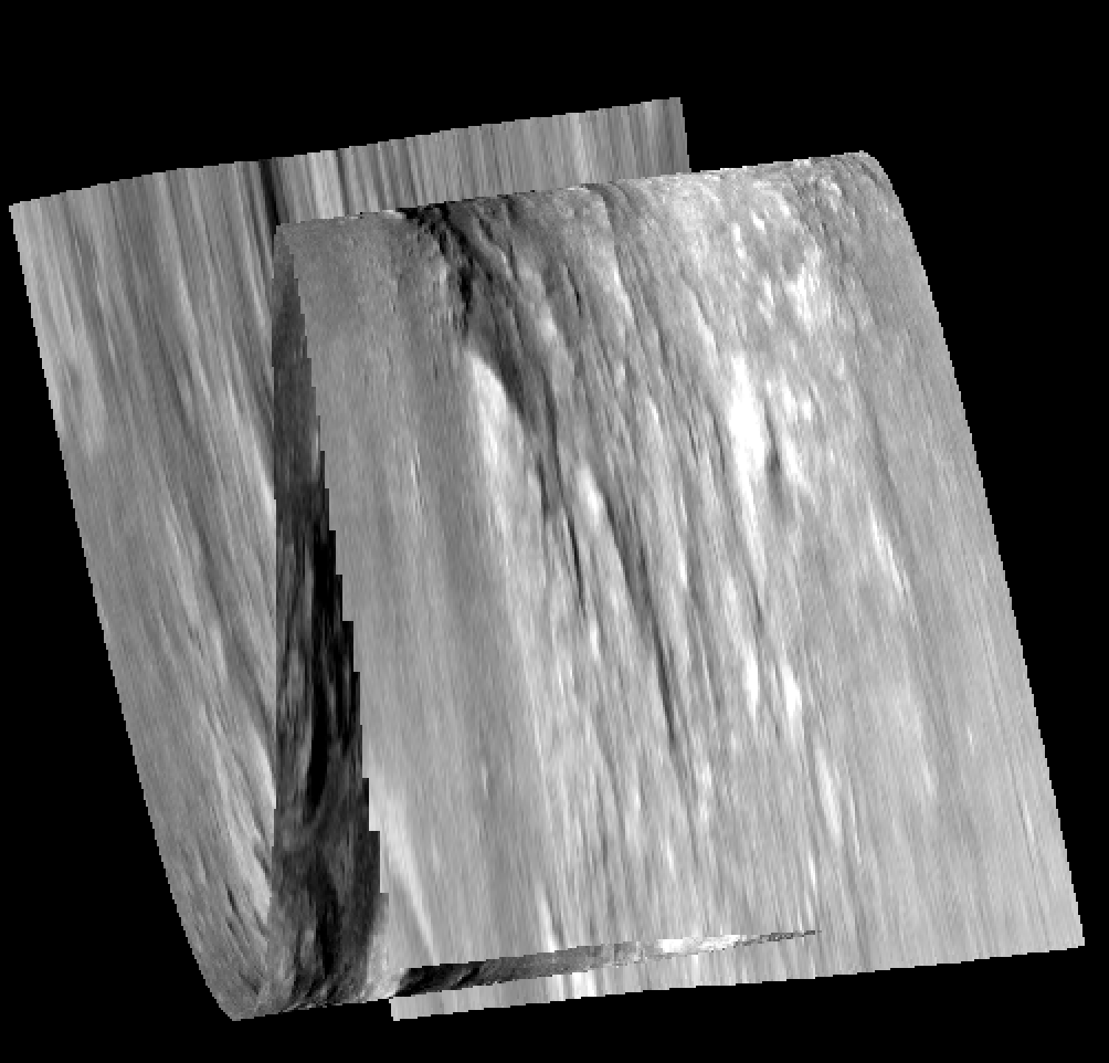
Applying __deltack__ on CRISM data, even with no expected change in pointing, cam2map results in a wavy image. Without the __deltack__ step, cam2map behaves normally.
How to reproduce
frt00008236_07_if164l_trr3.l0.cub.zip
spiceinit from=frt00008236_07_if164l_trr3.l0.cub attach=yes
pixel values extracted from campt, pointing should not change too much
deltack from=frt00008236_07_if164l_trr3.l0.cub samp1=300 line1=200 lat1=-8.75361 lon1=304.798
cam2map from=frt00008236_07_if164l_trr3.l0.cub to=frt00008236_07_if164l_trr3.map.cub
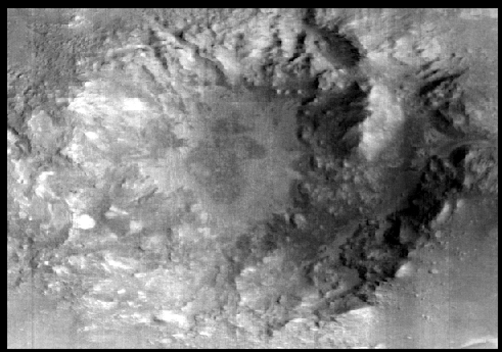
original cube
cam2map output of the deltack-corrected cub
Possible Solution
Additional context
 afrigeri
All 8 comments
Weird looking output. I wonder if the adjustment in deltack is fitting some sort of weird cubic polynomial that's causing the back and forth pattern. Gonna need to look at the pre and post adjustment pointing to see what's going on here.
 jessemapel
on 19 Mar 2020
jessemapel
on 19 Mar 2020
Try running deltack again and make method=direct.
I have been using deltack extensively on Cassini ISS images of Titan and Galileo SSI data of Europa using one line/sample lat/lon location along with method=direct and have gotten good results.
 lwellerastro
on 20 Mar 2020
lwellerastro
on 20 Mar 2020
Thanks @lwellerastro! the method=direct gives a better (not wavy/groovy) result, which gives a good registration just locally around the selected point, but elsewhere pixels are still off from the basemap.
afrigeri
on 24 Mar 2020
@lwellerastro Would it be possible to build a proper control network using just this image and a basemap in qnet then bundle adjusting? That seems like a much more rigorous way to tie a single image to a basemap.
jessemapel
on 24 Mar 2020
@afrigeri, you might want to add a second point or more if the app lets you. One point may be allowing for for some pivoting where a second might help stabilize it some. If tying to a base map, a control network would be better (along with running jigsaw), but there is a bit more work involved with that and possibly a steep learning curve.
You might have a look at some of the PDFs under the Demonstration Materials of the ISIS Github Wiki page https://github.com/USGS-Astrogeology/ISIS3/wiki/ISIS_Demo, Qnet.pdf in particular. Tying to a base map is covered in the last few slides. There is a lot to this demo and things are assumed and it appears some things are left out (like what to do when you open qnet). It's possible there is additional information in one of the other demo's or lessons, but I can't say for sure. Just be aware all the information you might need may not be there.
lwellerastro
on 24 Mar 2020
@jessemapel - I've proceeded to qnet as suggested by @lwellerastro, producing a cnet with several points ( @lwellerastro - the direct method of deltack offers just one point option ) tied to a ground source. jigsaw updated the pointing, but then cam2map produced the wavy/weird output again.
afrigeri
on 26 Mar 2020
@afrigeri, I have questions.
- what was your ground source?
- did you pass jigsaw a spiced file (not a deltack'd version)?
- how many points did you pick?
- how did you run jigsaw - what did you solve for?
- what sort of results did you get from jigsaw?
- Sigma0 for the final iteration; how many iterations for convergence
- what were the residuals like on the measures (see residuals.csv)
You could also share your bundleout.txt. And/or your network - I downloaded your image, reran spiceinit and projected. Looks good as you indicated. I am working from home on a not so awesome connection, but I can view small networks and run isis commands just fine.
It's not clear what's going on so we could use a bit more information. Thanks!
lwellerastro
on 27 Mar 2020
I am a bot that cleans up old issues that do not have activity.
This issue has not received feedback in the last six months. I am going to add the inactive label to
this issue. If this is still a pertinent issue, please add a comment or add an emoji to an existing comment.
I will post again in five months with another reminder and will close this issue on it's birthday unless it has
some activity.
 ascbot
on 25 Sep 2020
ascbot
on 25 Sep 2020
Related issues
 oleg-alexandrov
·
8Comments
oleg-alexandrov
·
8Comments
 adakite
·
5Comments
adakite
·
5Comments
 AndrewAnnex
·
7Comments
AndrewAnnex
·
7Comments
 dpmayerUSGS
·
6Comments
dpmayerUSGS
·
6Comments
 Kelvinrr
·
3Comments
Kelvinrr
·
3Comments