Electricitymap-contrib: island "Jan Mayen" (Norway) included in wrong zone (NO instead of SJ)
Hey guys!
The islands "Svalbard and Jan Mayen" are seperated from Norway and have the region code "SJ".
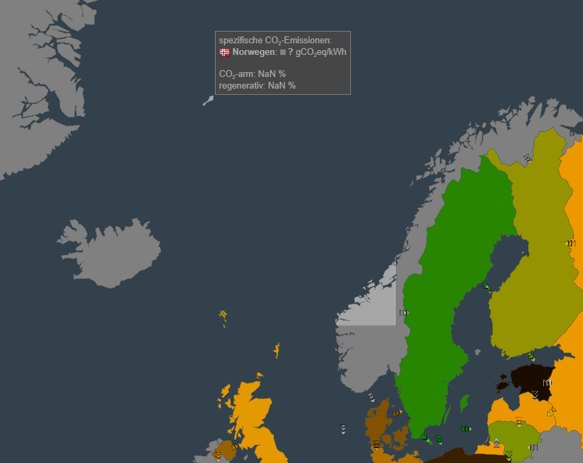
If you hover over the island Jan Mayen (northeast of Iceland) it highlights the entire mainland of Norway and would also show the same CO2 intensity.
It was mentioned in #802 and #1058
The effort to seperate this will be the highest per capita (18 inhabitants/scientists on Jan Mayen!). 😄
 alixunderplatz
All 3 comments
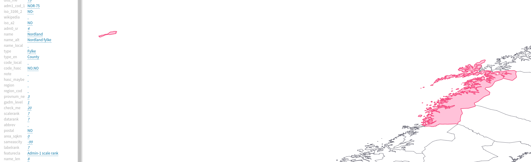
Annoyingly, this is because Jan Mayen is part of Nordland fylke in the Natural Earth shapefiles. We'd have to load Norway from a separate GeoJSON or find a way to subtract a GeoJSON from Norway... Maybe the topo changes in #1064 will make it easier?
 jarek
on 7 Feb 2018
jarek
on 7 Feb 2018
It's not going to be easy imo. We could manually edit the state shapefiles for Norway, clipping the Jan Mayen feature into it's own shapefile. But the problem is that Jan Mayen would still be in the natural earth shapefile and show as part of Norway on highlight.
So we'd have to do something like clipping Nordland fylke minus Jan Mayen into it's own file then run a filter against the natural earth shapes to swap in our own customized ones to avoid duplication on the map.
I've been playing around with these options for King Island in Tasmania but so far don't have a satisfactory answer.
 systemcatch
on 9 Feb 2018
systemcatch
on 9 Feb 2018
this ended up being resolved by splitting Norway into bidding zones (#1395)
jarek
on 10 May 2018
Related issues
 brunolajoie
·
3Comments
brunolajoie
·
3Comments
 corradio
·
5Comments
corradio
·
5Comments
 StefanAO
·
4Comments
systemcatch
·
3Comments
corradio
·
4Comments
StefanAO
·
4Comments
systemcatch
·
3Comments
corradio
·
4Comments
Most helpful comment
this ended up being resolved by splitting Norway into bidding zones (#1395)