Electricitymap-contrib: Split generation by island for Canaries
Is it possible to split canary island into the islands.
they are really working for there own.
see also:
http://ree.es/en/activities/canary-islands-electricity-system/canary-electricity-demand-in-real-time
El Hierro is very impressiv: rigth now 100% RE / 0 CO2
source:
https://demanda.ree.es/movil/canarias/el_hierro/total
 strassburger
All 8 comments
"inside look" from outside to El Hierro "Gorona del Viento":
http://euanmearns.com/el-hierro-portal/
strassburger
on 15 Jul 2017
A quick look at this one reveals that the page makes a request to https://demanda.ree.es/WSvisionaMovilesCanariasRest/resources/demandaGeneracionCanarias?callback=angular.callbacks._2&curva=EL_HIERRO&fecha=2017-10-31 which then returns json data for each 10 minute interval. It shouldn't be hard to write a parser for this.
 systemcatch
on 31 Oct 2017
systemcatch
on 31 Oct 2017
As was mentioned in the Slack channel, the current parser for Canary Islands uses https://pypi.python.org/pypi/reescraper which already splits up the data by island. Unfortunately our map data source (Natural Earth) doesn't break apart the islands, so integration on the map side is a bit tricky.
It should be feasible to just use the currently generated GeoJSON (/web/app/world.json) and extract the polygons for all the islands, then split it into separate islands manually - they're already separate polygons for each island on the map.
 jarek
on 2 Nov 2017
jarek
on 2 Nov 2017
I've managed to separate out the individual Canary Island's from the natural earth .shp files which I'll submit a PR for soon. @blackleg you should be able to return data by Island rather than in aggregate now.
systemcatch
on 23 Jan 2018
@systemcatch Great work. :+1:
 hectorespert
on 23 Jan 2018
hectorespert
on 23 Jan 2018
Thanks very much you all.
strassburger
on 23 Jan 2018
hectorespert
on 26 Jan 2018
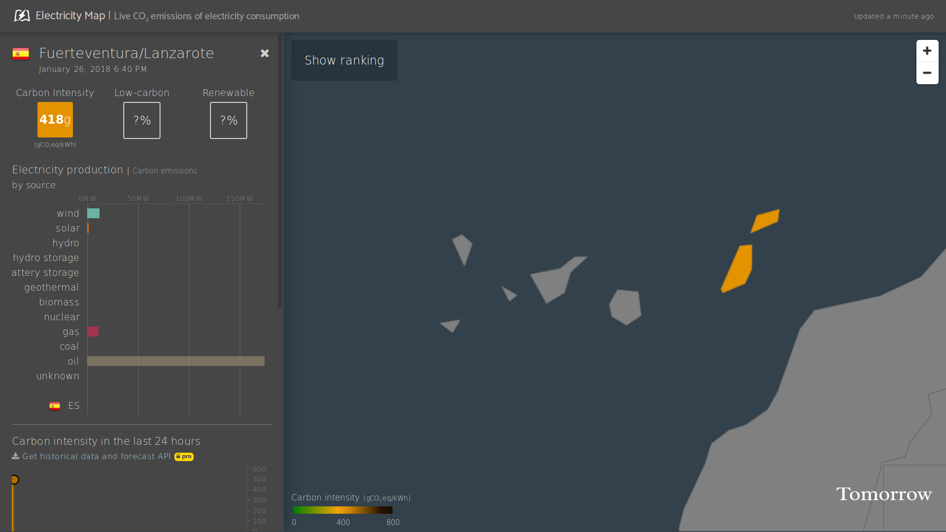
The pull request: https://github.com/tmrowco/electricitymap/pull/1028
hectorespert
on 26 Jan 2018
Related issues
 brunolajoie
·
3Comments
brunolajoie
·
3Comments
 Alain-Ivadolabs-Ext
·
4Comments
Alain-Ivadolabs-Ext
·
4Comments
 consideRatio
·
4Comments
consideRatio
·
4Comments
 StefanAO
·
4Comments
StefanAO
·
4Comments
 corradio
·
4Comments
corradio
·
4Comments
Most helpful comment