Collect: Make coordinates for GeoTrace and GeoShape more readable
Problem description
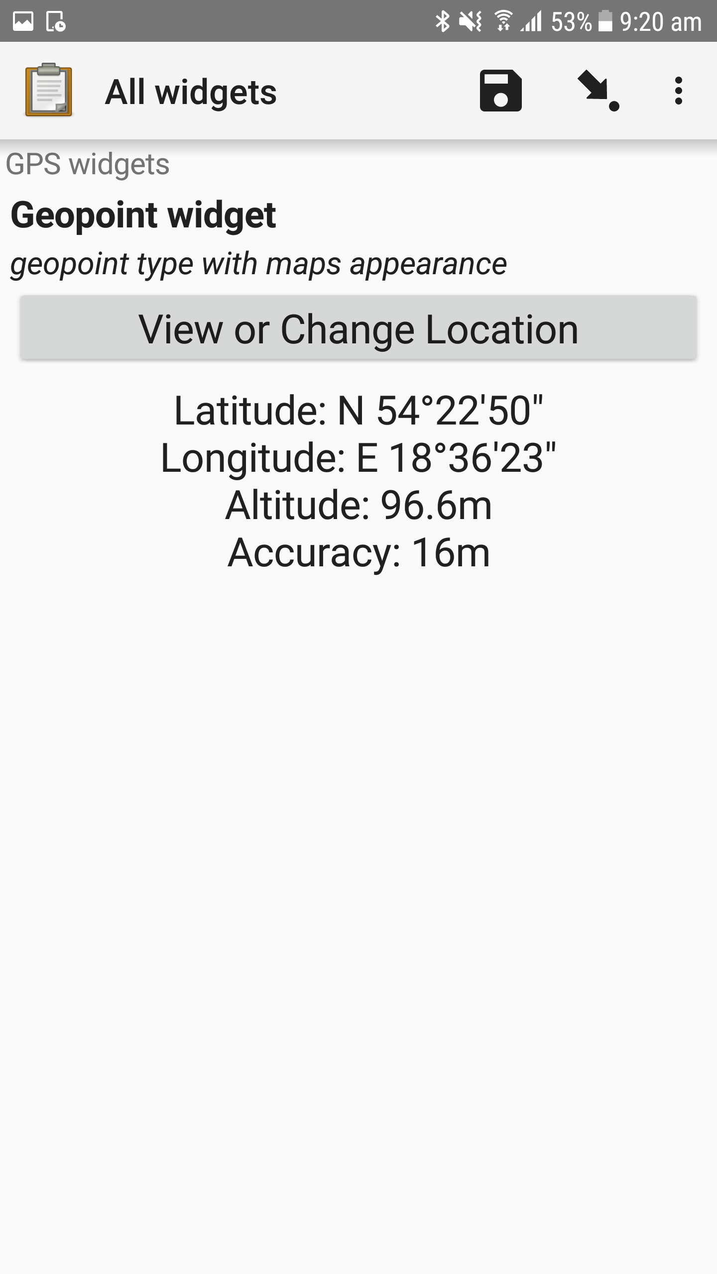
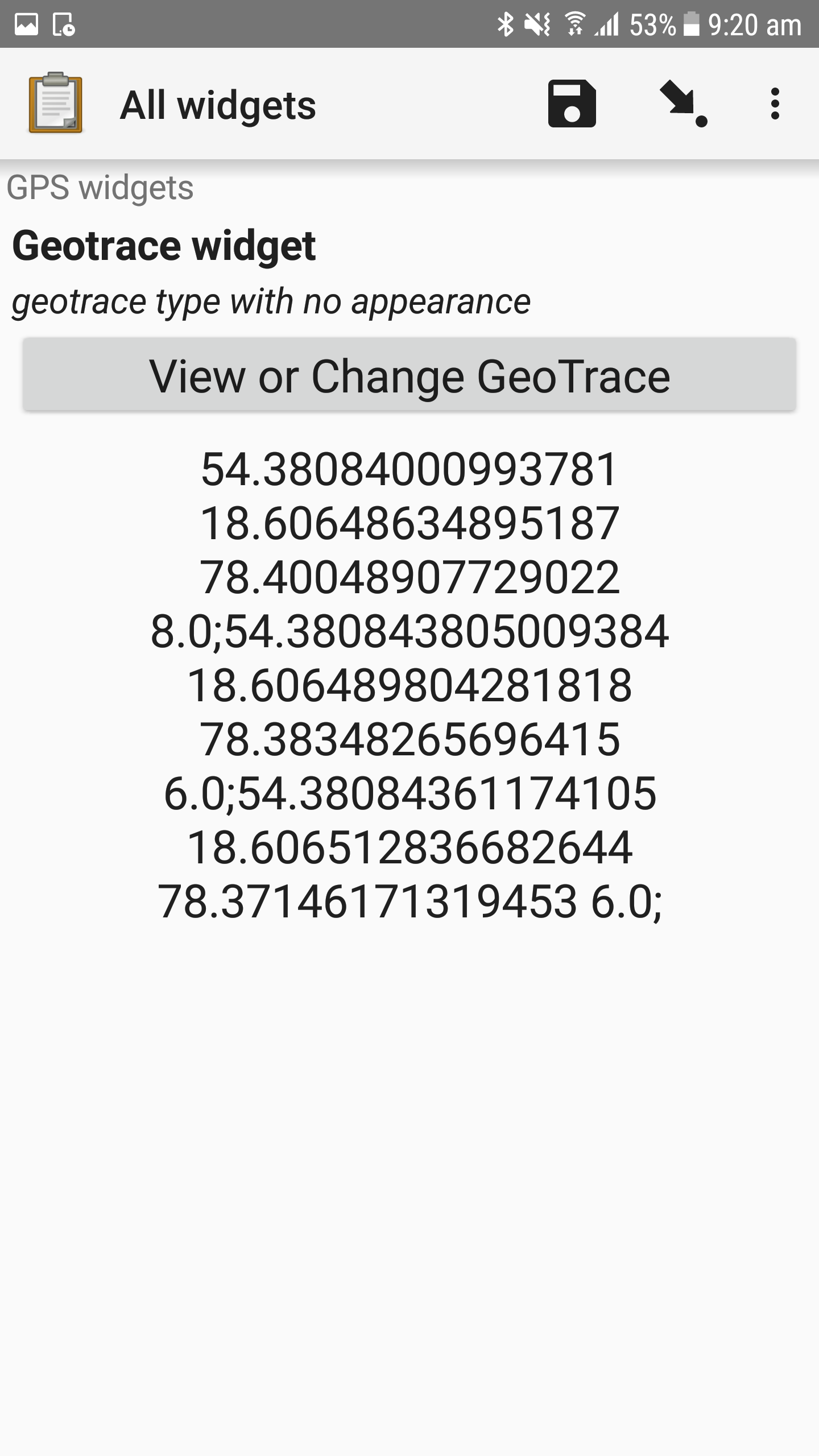
Coordinates are not readable easily.
|GeoPoint|GeoTrace|GeoShape|
|---|---|---|
| |
| |
| |
|
Steps to reproduce the problem
- User adds few points to GeoTrace or GeoShape widget
- User saves
- User tries to read coordinates
Expected behavior
Add full information about Latitude/Longitude/Altitude/Accuracy like in GeoPoint widget
OR points are separated by a new line etc.
needs discussion
 mmarciniak90
All 2 comments
@opendatakit-bot label "needs discussion"
mmarciniak90
on 3 Apr 2019
Taking into account UI improvements we want to implement and material design probably it would be better to get rid of those coordinates at all and display that part of the map (selected point/geoshape/geotrace). Or maybe two tabs - the map and cooridnates if we don't want to get rid of them.
 grzesiek2010
on 3 Apr 2019
grzesiek2010
on 3 Apr 2019
👍3
Was this page helpful?
0 / 5 - 0 ratings
Related issues
 nribeka
·
4Comments
nribeka
·
4Comments
 yanokwa
·
3Comments
yanokwa
·
3Comments
 dr0pdb
·
5Comments
dr0pdb
·
5Comments
 mateusmedeiros
·
4Comments
mmarciniak90
·
5Comments
mateusmedeiros
·
4Comments
mmarciniak90
·
5Comments
Most helpful comment
Taking into account UI improvements we want to implement and material design probably it would be better to get rid of those coordinates at all and display that part of the map (selected point/geoshape/geotrace). Or maybe two tabs - the map and cooridnates if we don't want to get rid of them.