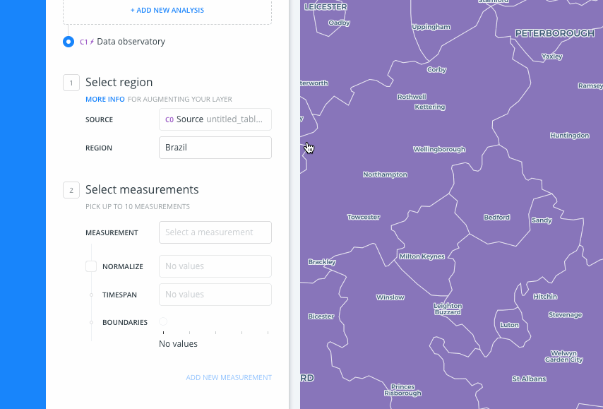
Cartodb: A few errors in the DO Analysis UI
- [ ] We shouldn't be showing this. Is this because of where the geometry is situated?
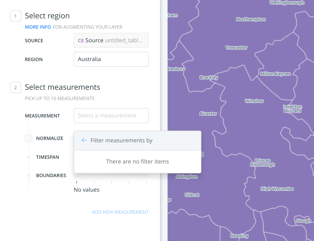
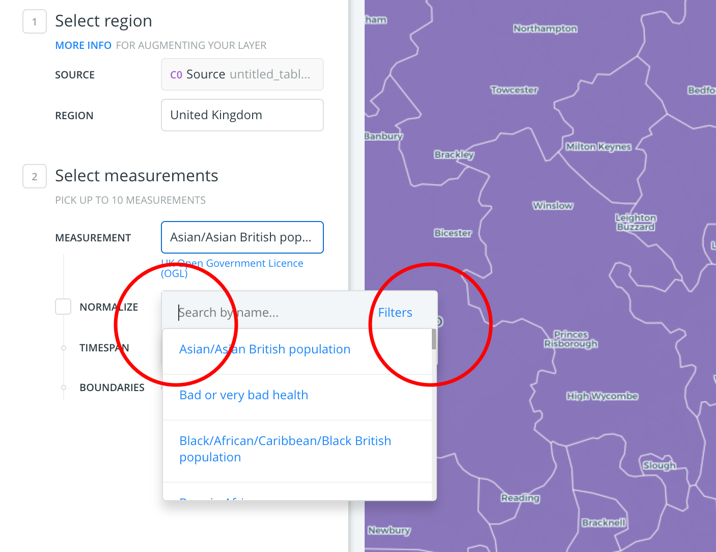
- [ ] When there are measurements available, the dropdown also behaves incorrectly. It opens on top of the following input, it adds border-radius to the options list where there shouldn't be any, and the search box appears a few pixels to the left of the options list.

- [ ] There shouldn't be any more line below the "Boundaries" point.
- [ ] There's more margin than it should be between "Measurement" and "Normalize"
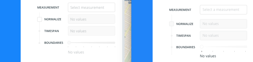
(Left: Mockup | Right: Production)
.carto used:
Demographics of the United Kingdom.zip
 arianaescobar
All 7 comments
@antoniocarlon can you answer Ari's questions before pushing this to the RT kanban?
 ramiroaznar
on 16 Jan 2018
ramiroaznar
on 16 Jan 2018
We are using the geometries' extent to get the available numerators. For example:
https://xxx.carto.com/api/v2/sql?q=SELECT%20numer_id%2C%20numer_name%2C%20numer_description%2C%20numer_type%2C%20numer_aggregate%2C%20numer_tags%20FROM%20_OBS_GetNumerators((SELECT%20ST_SetSRID(ST_Extent(the_geom)%2C%204326)%20FROM%20(SELECT%20*%20FROM%20my_table)%20q)%2C%20section_tags%20%3D%3E%20%27%7Bsection%2Ftags.au%7D%27)%20ORDER%20BY%20numer_name%20ASC&api_key=my_api_key
 antoniocarlon
on 16 Jan 2018
antoniocarlon
on 16 Jan 2018
@antoniocarlon I didn't understand that sorry.
arianaescobar
on 16 Jan 2018
@arianaescobar The answer is yes. I asked Antonio to let us know how BUILDER gets the numerators (measures) in order to understand if this is a backend issue or not. And it does. So to avoid showing those countries, we need to use the SQL API with OBS_GetAvailableBoundaries for example.
@javitonino should fix this 1st part, and @elenatorro will take care of the frontend part.
ramiroaznar
on 16 Jan 2018
Perfect. Thanks!
arianaescobar
on 16 Jan 2018
I would say this is a frontend task. The only thing a bit more backend would be to adjust the query, but the query itself is run from JS code (so frontend). And the rest of stuff (cosmetic) is pure frontend.
I can help the frontender with the query if necessary (but I think it's easy enough). Basically, we have to pass the bounding box to the OBS_GetAvailableNumerators function as Antonio mentioned. We already do that for the numerators, so it would be just a question of copying that to the region-listing query.
 javitonino
on 16 Jan 2018
javitonino
on 16 Jan 2018
Stale issue. Closing 👋
 alrocar
on 1 Oct 2019
alrocar
on 1 Oct 2019
Related issues
 saleiva
·
4Comments
saleiva
·
4Comments
 rochoa
·
3Comments
ramiroaznar
·
4Comments
arianaescobar
·
4Comments
rochoa
·
3Comments
ramiroaznar
·
4Comments
arianaescobar
·
4Comments
 xavijam
·
3Comments
xavijam
·
3Comments